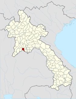
Sangthong district
Appearance
move to sidebar
hide
| Sangthong district ສັງທອງSangthong |
|
|---|---|
| District | |
| Coordinates: 18°05′27″N 102°17′24″E / 18.09083°N 102.29000°E / 18.09083; 102.29000 | |
| Country | Laos |
| Province | Vientiane Prefecture |
| District | Sangthong |
| Population (2015) | |
| • District | 29,509 |
| • Urban | 5,962 |
| Time zone | UTC+7 (ICT) |
Sangthong is a district of Vientiane Prefecture, Laos.
References
- ^ «Results of Housing and Population and Housing Census 2015» (PDF). United Nations Population Fund in Laos. Lao Statistics Bureau. p. 100. Archived from the original (PDF) on 19 February 2024. Retrieved 24 February 2024.
- ^ Google Maps (Map). Google.
- ^ Bing Maps (Map). Microsoft and Harris Corporation Earthstar Geographics LLC.
Districts of Central Laos |
|
|---|---|
| Vientiane Prefecture | |
| Bolikhamsai province | |
| Vientiane province | |
| Xaisomboun province | |
| ※ denotes provincial seat. | |
 |
This Laotian location article is a stub. You can help Wikipedia by expanding it. |
- v
- t
- e