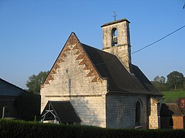
Boubers-lès-Hesmond
In this article we will explore Boubers-lès-Hesmond, a topic that has attracted great interest in recent years. We will learn about its importance, its impact on various aspects of daily life and how it has evolved over time. In addition, we will analyze the different perspectives that exist around Boubers-lès-Hesmond and how it has influenced different areas. It will be a journey through the history, present and future of Boubers-lès-Hesmond, in which we will discover its implications and its relevance in today's society.
Boubers-lès-Hesmond | |
|---|---|
 The church of Boubers-lès-Hesmond | |
| Coordinates: 50°28′34″N 1°57′00″E / 50.4761°N 1.95°E | |
| Country | France |
| Region | Hauts-de-France |
| Department | Pas-de-Calais |
| Arrondissement | Montreuil |
| Canton | Auxi-le-Château |
| Intercommunality | CC des 7 Vallées |
| Government | |
| • Mayor (2020–2026) | Francis Tetard[1] |
Area 1 | 1.74 km2 (0.67 sq mi) |
| Population (2022)[2] | 70 |
| • Density | 40/km2 (100/sq mi) |
| Time zone | UTC+01:00 (CET) |
| • Summer (DST) | UTC+02:00 (CEST) |
| INSEE/Postal code | 62157 /62990 |
| Elevation | 46–132 m (151–433 ft) (avg. 53 m or 174 ft) |
| 1 French Land Register data, which excludes lakes, ponds, glaciers > 1 km2 (0.386 sq mi or 247 acres) and river estuaries. | |
Boubers-lès-Hesmond is a commune in the Pas-de-Calais département in the Hauts-de-France region in northern France.[3]
Geography
Boubers-lès-Hesmond is a small village situated some 10 miles (16 km) east of Montreuil-sur-Mer on the D149 road.
Population
| Year | Pop. | ±% p.a. |
|---|---|---|
| 1968 | 90 | — |
| 1975 | 85 | −0.81% |
| 1982 | 71 | −2.54% |
| 1990 | 71 | +0.00% |
| 1999 | 77 | +0.91% |
| 2009 | 71 | −0.81% |
| 2014 | 79 | +2.16% |
| 2020 | 75 | −0.86% |
| Source: INSEE[4] | ||
See also
References
- ^ "Répertoire national des élus: les maires". data.gouv.fr, Plateforme ouverte des données publiques françaises (in French). 2 December 2020.
- ^ "Populations de référence 2022" (in French). The National Institute of Statistics and Economic Studies. 19 December 2024.
- ^ INSEE commune file
- ^ Population en historique depuis 1968, INSEE


