|
|
Name on the Register
|
Image
|
Date listed
|
Location
| Subdistrict |
Description
|
| 1
|
Aklis Archeological Site
|
 Aklis Archeological Site Aklis Archeological Site
|
July 1, 1976
(#76001852)
|
Sandy Point National Wildlife Refuge
| Frederiksted |
|
| 2
|
Bethlehem Middle Works Historic District
|
|
July 6, 1988
(#87001932)
|
King's Quarter
17°43′04″N 64°47′33″W / 17.717639°N 64.7925°W / 17.717639; -64.7925 (Bethlehem Middle Works Historic District)
| Southcentral |
|
| 3
|
Christiansted Historic District
|
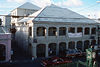 Christiansted Historic District Christiansted Historic District
|
July 30, 1976
(#76002266)
|
Roughly bounded by Christiansted Harbor, New, Peter's Farm Hospital, and West Streets
17°44′46″N 64°42′16″W / 17.746111°N 64.704444°W / 17.746111; -64.704444 (Christiansted Historic District)
| Christiansted |
|
| 4
|
Christiansted National Historic Site
|
 Christiansted National Historic Site Christiansted National Historic Site
|
October 15, 1966
(#66000077)
|
Bounded by King, Queen, and Queens Cross Streets and Christiansted Harbor
17°44′56″N 64°42′08″W / 17.748889°N 64.702222°W / 17.748889; -64.702222 (Christiansted National Historic Site)
| Christiansted |
|
| 5
|
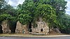
Coakley Bay Estate
|
 Coakley Bay Estate Coakley Bay Estate
|
July 23, 1976
(#76001841)
|
East of Christiansted
17°45′31″N 64°38′28″W / 17.758559°N 64.641011°W / 17.758559; -64.641011 (Coakley Bay Estate)
| East End |
Sugarcane plantation site, with 20 feet (6.1 m)-tall stonework of a windmill
|
| 6
|
Columbus Landing Site
|
 Columbus Landing Site Columbus Landing Site
|
October 15, 1966
(#66000743)
|
East of Greig Hill on Salt River Bay
17°46′43″N 64°45′34″W / 17.778501°N 64.759557°W / 17.778501; -64.759557 (Columbus Landing Site)
| East End |
|
| 7
|
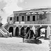
Danish West India and Guinea Company Warehouse
|
 Danish West India and Guinea Company Warehouse Danish West India and Guinea Company Warehouse
|
October 9, 1974
(#74001940)
|
Church and Company Streets
17°44′47″N 64°42′09″W / 17.7464°N 64.7026°W / 17.7464; -64.7026 (Danish West India and Guinea Company Warehouse)
| Christiansted |
|
| 8
|
Diamond School
|
|
July 1, 1976
(#76001842)
|
West of Christiansted on Centerline Road
17°42′47″N 64°49′47″W / 17.712917°N 64.829722°W / 17.712917; -64.829722 (Diamond School)
| Southcentral |
|
| 9
|
Estate Butler's Bay
|
 Estate Butler's Bay Estate Butler's Bay
|
August 25, 1978
(#78002722)
|
North of Frederiksted
17°44′57″N 64°53′32″W / 17.749028°N 64.892222°W / 17.749028; -64.892222 (Estate Butler's Bay)
| Northwest |
|
| 10
|
Estate Grove Place
|
 Estate Grove Place Estate Grove Place
|
July 17, 1978
(#78002721)
|
4 miles (6.4 km) east of Frederiksted off Centerline Road
17°43′39″N 64°49′27″W / 17.727577°N 64.82419°W / 17.727577; -64.82419 (Estate Grove Place)
| Northwest |
Sugar factory, chimney, and wagon depot
|
| 11
|
Estate Hogansborg
|
|
February 17, 1978
(#78002723)
|
East of Frederiksted off Centerline Road
17°42′39″N 64°50′44″W / 17.710972°N 64.845556°W / 17.710972; -64.845556 (Estate Hogansborg)
| Northwest |
|
| 12
|
Estate Judith's Fancy
|
 Estate Judith's Fancy Estate Judith's Fancy
|
July 17, 1978
(#78002717)
|
4 miles (6.4 km) northwest of Christiansted
17°46′41″N 64°44′44″W / 17.778194°N 64.745694°W / 17.778194; -64.745694 (Estate Judith's Fancy)
| Sion Farm |
|
| 13
|
Estate La Reine
|
|
November 24, 1980
(#80003994)
|
20 Kings Quarter and 19 Queens Quarter
17°44′09″N 64°46′19″W / 17.735972°N 64.771944°W / 17.735972; -64.771944 (Estate La Reine)
| Northcentral |
|
| 14
|
Estate Little Princess
|
 Estate Little Princess Estate Little Princess
|
June 9, 1980
(#80003995)
|
Northwest of Christiansted
17°45′35″N 64°43′31″W / 17.759861°N 64.725278°W / 17.759861; -64.725278 (Estate Little Princess)
| Sion Farm |
|
| 15
|
Estate Mount Victory
|
|
February 17, 1978
(#78002724)
|
Northeast of Frederiksted
17°45′13″N 64°52′05″W / 17.75375°N 64.868056°W / 17.75375; -64.868056 (Estate Mount Victory)
| Northwest |
|
| 16
|
Estate Prosperity
|
|
February 17, 1978
(#78002725)
|
North of Frederiksted
17°43′42″N 64°52′53″W / 17.728472°N 64.881389°W / 17.728472; -64.881389 (Estate Prosperity)
| Northwest |
|
| 17
|
Estate Saint George Historic District
|
 Estate Saint George Historic District Estate Saint George Historic District
|
October 24, 1986
(#86003351)
|
Prince Quarter
17°43′05″N 64°49′49″W / 17.717917°N 64.830139°W / 17.717917; -64.830139 (Estate Saint George Historic District)
| Northwest |
|
| 18
|
Estate St. John
|
|
June 9, 1978
(#78002718)
|
3 miles (4.8 km) northwest of Christiansted
17°45′57″N 64°44′48″W / 17.765972°N 64.746667°W / 17.765972; -64.746667 (Estate St. John)
| Sion Farm |
|
| 19
|
Fair Plain Archeological District
|
 Fair Plain Archeological District Fair Plain Archeological District
|
September 29, 1976
(#76001843)
|
Address Restricted
| Christiansted |
|
| 20
|
Fairplain Historic and Archeological District
|
Fairplain Historic and Archeological District
|
July 6, 1988
(#87001903)
|
Address Restricted
| Christiansted |
|
| 21
|
Frederiksted Historic District
|
 Frederiksted Historic District Frederiksted Historic District
|
August 9, 1976
(#76001853)
|
Roughly bounded by Fisher Street, the cemetery, and Fort Frederik
17°42′44″N 64°52′53″W / 17.712222°N 64.881389°W / 17.712222; -64.881389 (Frederiksted Historic District)
| Frederiksted |
|
| 22
|
Friedensfeld Midlands Moravian Church and Manse
|
 Friedensfeld Midlands Moravian Church and Manse Friedensfeld Midlands Moravian Church and Manse
|
July 1, 1976
(#76001844)
|
West of Christiansted
17°44′53″N 64°46′48″W / 17.748194°N 64.78°W / 17.748194; -64.78 (Friedensfeld Midlands Moravian Church and Manse)
| Northcentral |
|
| 23
|
Friedensthal Mission
|
 Friedensthal Mission Friedensthal Mission
|
August 25, 1978
(#78002719)
|
Southwest of Christiansted
17°44′39″N 64°42′35″W / 17.744028°N 64.709722°W / 17.744028; -64.709722 (Friedensthal Mission)
| Christiansted |
|
| 24
|
Ft. Frederik of US Virgin Islands
|
 Ft. Frederik of US Virgin Islands Ft. Frederik of US Virgin Islands
|
September 25, 1997
(#96001073)
|
South of junction of Mahogany Road and U.S. Virgin Island Highway 631, north end of Frederiksted
17°42′55″N 64°53′01″W / 17.715278°N 64.883611°W / 17.715278; -64.883611 (Ft. Frederik of US Virgin Islands)
| Frederiksted |
|
| 25
|
Great Pond Archeological Site
|
Great Pond Archeological Site
|
July 12, 1976
(#76001845)
|
Address Restricted
| Christiansted |
|
| 26
|
Green Kay
|
|
July 19, 1976
(#76001846)
|
East of Christiansted
17°45′32″N 64°39′16″W / 17.758895°N 64.654363°W / 17.758895; -64.654363 (Green Kay)
| East End |
|
| 27
|
Hams Bluff Light
|
 Hams Bluff Light Hams Bluff Light
|
September 16, 2019
(#100004382)
|
Crest of Hams Bluff, 1400 feet east of N. end of Hams Bluff Rd.
17°46′09″N 64°52′15″W / 17.7692°N 64.8709°W / 17.7692; -64.8709 (Hams Bluff Light)
| Frederiksted |
|
| 28
|
La Grande Princesse School
|
|
July 12, 1976
(#76001847)
|
Northeast of Christiansted
17°45′29″N 64°43′51″W / 17.758194°N 64.730833°W / 17.758194; -64.730833 (La Grande Princesse School)
| Sion Farm |
|
| 29
|
Little La Grange
|
|
October 22, 1976
(#76001854)
|
Northeast of Frederiksted
17°43′47″N 64°51′54″W / 17.729861°N 64.865°W / 17.729861; -64.865 (Little La Grange)
| Northwest |
|
| 30
|
Lower Granard Archeological District
|
Lower Granard Archeological District
|
July 1, 1976
(#76001849)
|
Address Restricted
| Christiansted |
|
| 31
|
Prosperity Archeological Site
|
Prosperity Archeological Site
|
July 12, 1976
(#76001855)
|
Address Restricted
| Frederiksted |
|
| 32
|
Richmond Prison Detention and Workhouse
|
|
February 14, 1978
(#78002720)
|
West of Christiansted
17°44′53″N 64°42′45″W / 17.748194°N 64.7125°W / 17.748194; -64.7125 (Richmond Prison Detention and Workhouse)
| Christiansted |
|
| 33
|
River Archeological Site
|
River Archeological Site
|
July 1, 1976
(#76001856)
|
Address Restricted
| Frederiksted |
|
| 34
|
St. John's Episcopal Church
|
 St. John's Episcopal Church St. John's Episcopal Church
|
October 4, 2016
(#16000698)
|
Plot #27 King Street
17°44′35″N 64°42′28″W / 17.742926°N 64.707751°W / 17.742926; -64.707751 (St. John's Episcopal Church)
| Christiansted |
|
| 35
|
Salt River Bay National Historic Site and Ecological Preserve
|
Salt River Bay National Historic Site and Ecological Preserve
|
February 24, 1992
(#01000280)
|
2100 Church Street
17°46′52″N 64°45′23″W / 17.781111°N 64.756389°W / 17.781111; -64.756389 (Salt River Bay National Historic Site and Ecological Preserve)
| Christiansted |
|
| 36
|
Sion Hill
|
 Sion Hill Sion Hill
|
July 19, 1976
(#76001850)
|
West of Christiansted
17°44′35″N 64°44′41″W / 17.742917°N 64.744722°W / 17.742917; -64.744722 (Sion Hill)
| Sion Farm |
|
| 37
|
Slob Historic District
|
|
November 12, 1987
(#87001929)
|
King's Quarter
17°43′54″N 64°46′16″W / 17.731667°N 64.771111°W / 17.731667; -64.771111 (Slob Historic District)
| Sion Farm |
|
| 38
|
St. Georges Archeological Site
|
St. Georges Archeological Site
|
September 29, 1976
(#76001857)
|
Address Restricted
| Frederiksted |
|
| 39
|
Strawberry Hill Historic District
|
|
October 2, 1987
(#87001934)
|
Queen's Quarter
17°43′57″N 64°45′37″W / 17.7324601°N 64.7603138°W / 17.7324601; -64.7603138 (Strawberry Hill Historic District)
| Sion Farm |
|
| 40
|
Upper Salt River Archeological District
|
Upper Salt River Archeological District
|
September 1, 1976
(#76001851)
|
Address Restricted
| Christiansted |
|
| 41
|
Whim
|
 Whim Whim
|
July 30, 1976
(#76001858)
|
1.7 miles (2.7 km) southeast of Frederiksted on Centerline Road
17°42′10″N 64°51′47″W / 17.702639°N 64.863056°W / 17.702639; -64.863056 (Whim)
| Southwest |
|
 Map of the United States Virgin Islands


.jpg)


.jpg)
.jpg)


.jpg)

_(US48%2B2).svg)