Branchville, Virginia
This article will address the topic of Branchville, Virginia, which has captured the attention of a wide spectrum of people today. Various aspects related to Branchville, Virginia will be explored, from its origin and evolution to its relevance in contemporary society. Its implications in different areas will also be examined, as well as the opinions and positions of experts and specialists in the field. Through an in-depth analysis, we will seek to provide a comprehensive and enriching vision of Branchville, Virginia, with the aim of offering readers a broader and more detailed understanding of this fascinating topic.
Branchville, Virginia | |
|---|---|
 Town hall and fire station | |
 Location of Branchville, Virginia | |
| Coordinates: 36°34′9″N 77°14′56″W / 36.56917°N 77.24889°W | |
| Country | United States |
| State | Virginia |
| County | Southampton |
| Area | |
• Total | 0.43 sq mi (1.11 km2) |
| • Land | 0.43 sq mi (1.11 km2) |
| • Water | 0.00 sq mi (0.00 km2) |
| Elevation | 43 ft (13 m) |
| Population (2010) | |
• Total | 114 |
• Estimate (2019)[2] | 115 |
| • Density | 269.32/sq mi (104.02/km2) |
| Time zone | UTC−5 (Eastern (EST)) |
| • Summer (DST) | UTC−4 (EDT) |
| ZIP code | 23828 |
| Area code(s) | 757, 948 |
| FIPS code | 51-09208[3] |
| GNIS feature ID | 1463757[4] |
Branchville is a town in Southampton County, Virginia, United States. The population was 123 at the 2000 census.
Geography
Branchville is located at 36°34′9″N 77°14′56″W / 36.56917°N 77.24889°W (36.569266, −77.248997).[5]
According to the United States Census Bureau, the town has a total area of 0.4 square mile (1.1 km2), all land.
Demographics
| Census | Pop. | Note | %± |
|---|---|---|---|
| 1910 | 239 | — | |
| 1920 | 148 | −38.1% | |
| 1930 | 161 | 8.8% | |
| 1940 | 153 | −5.0% | |
| 1950 | 169 | 10.5% | |
| 1960 | 158 | −6.5% | |
| 1970 | 189 | 19.6% | |
| 1980 | 174 | −7.9% | |
| 1990 | 55 | −68.4% | |
| 2000 | 123 | 123.6% | |
| 2010 | 114 | −7.3% | |
| 2019 (est.) | 115 | [2] | 0.9% |
| U.S. Decennial Census[6] | |||
At the 2000 census there were 123 people, 50 households, and 36 families living in the town. The population density was 281.9 people per square mile (107.9/km2). There were 56 housing units at an average density of 128.4 per square mile (49.1/km2). The racial makeup of the town was 67.48% White, 30.89% African American, 0.81% Asian, and 0.81% from two or more races.[3] Of the 50 households 32.0% had children under the age of 18 living with them, 52.0% were married couples living together, 20.0% had a female householder with no husband present, and 28.0% were non-families. 26.0% of households were one person and 24.0% were one person aged 65 or older. The average household size was 2.46 and the average family size was 2.97.
The age distribution was 24.4% under the age of 18, 5.7% from 18 to 24, 23.6% from 25 to 44, 23.6% from 45 to 64, and 22.8% 65 or older. The median age was 44 years. For every 100 females, there were 75.7 males. For every 100 females age 18 and over, there were 63.2 males.
The median household income was $24,844 and the median family income was $32,917. Males had a median income of $21,250 versus $19,583 for females. The per capita income for the town was $11,985. There were no families and 4.6% of the population living below the poverty line, including no under eighteens and 15.8% of those over 64.
References
- ^ "2019 U.S. Gazetteer Files". United States Census Bureau. Retrieved August 7, 2020.
- ^ a b "Population and Housing Unit Estimates". United States Census Bureau. May 24, 2020. Retrieved May 27, 2020.
- ^ a b "U.S. Census website". United States Census Bureau. Retrieved January 31, 2008.
- ^ "US Board on Geographic Names". United States Geological Survey. October 25, 2007. Retrieved January 31, 2008.
- ^ "US Gazetteer files: 2010, 2000, and 1990". United States Census Bureau. February 12, 2011. Retrieved April 23, 2011.
- ^ "Census of Population and Housing". Census.gov. Retrieved June 4, 2015.
Municipalities and communities of Southampton County, Virginia, United States | ||
|---|---|---|
| Towns | 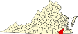 | |
| CDPs | ||
| Unincorporated communities | ||